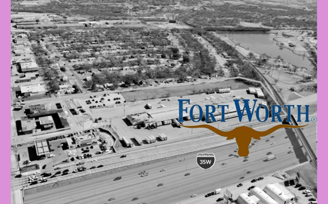
Fort Worth Aims to Transform East Berry Street into a Walkable, Bikeable Corridor
Share News:
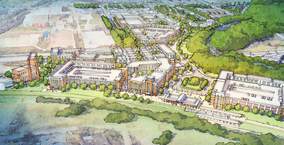
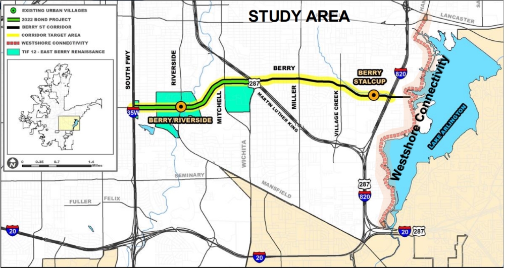
Fort Worth’s aging East Berry Street from I-35 West to Lake Arlington is poised for a significant makeover as a shiny new corridor plan is headed to City Council for briefing. The East Berry Street Corridor Plan seeks to transform the empty parking lots and vacant land of this south Fort Worth area into a walkable, bikeable, and transit-oriented environment with new housing, businesses, and public amenities.
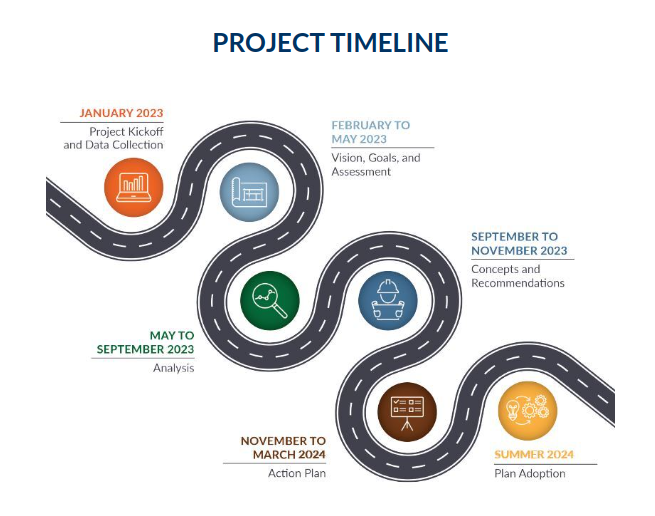
Fort Worth launched the concept for East Berry Street two years ago and held several public engagement sessions to gather feedback and educate residents on how approved 2022 bond projects fold into the detailed corridor plan. This corridor plan outlines a detailed vision and the strategic actions necessary to catalyze economic development and transform East Berry Street.
We love a good corridor plan at CandysDirt.com, and the 61-page East Berry Street document did not disappoint.
The study includes several key elements:
- A vision informed through a robust engagement process of listening to stakeholders, an advisory committee, residents, and businesses combined with technical considerations and performance expectations.
- Land use concepts that illustrate the vision through conceptual plans of catalytic sites, tailored to the identified needs for infill residential and commercial developments that provide residents opportunities to gather.
- Transportation enhancements that identify the necessary infrastructure to improve the corridor’s safety, connectivity, traffic flow, and walkability.
- Economic strategies that may be leveraged to realize the vision, catalyze development, and capitalize on both public and private sector investments throughout the corridor.
- An implementation strategy that outlines the necessary steps to realize the agreed-upon vision and goals, including key infrastructure investments and a form-based zoning code that will allow for the realization of the land use concepts.
Corridor Plan 101
Now, if you’re a reader of CandysDirt.com, then you’ve probably added “comprehensive land use plan” to your municipal lexicon by now. With the East Berry Street project, let’s add “corridor plan” to your vocabulary with this primer.
A corridor plan is a comprehensive strategy designed to guide the development and revitalization of a specific urban area, typically along a major road or transit route. It outlines the vision for land use, transportation, infrastructure, and public spaces within the corridor, aiming to enhance connectivity, encourage economic growth, and improve the overall quality of life. The plan often includes recommendations for zoning changes, design standards, and public investments to ensure that development aligns with the community’s goals and needs.
In this area just east of TCU and south of Texas Wesleyan, old fragmented development has stymied growth and movement through this underutilized corridor that crosses east and west between two major highways. This plan focuses on filling in vacant lots and underused spaces with new housing, businesses, and public amenities.
Corridor Plan Zoning
Kelly Porter, Fort Worth’s assistant director of transportation and public works, said a unique set of zoning guidelines for the project is still pending internal review, Ismael Belkoura reported in the July 30 edition of The Fort Worth Report.
“Sidewalks are proposed alongside the entirety of East Berry Street, with buffers between the sidewalk and the road,” the Fort Worth Report article states. “Mixed-use urban development is planned for East Berry Street in three different areas: Mississippi Avenue to Cobb Park; the intersection between Miller Avenue and East Berry Street; and from Stalcup Road to the lakefront. The plan outlines redevelopment based on form-based coding, which is generally pedestrian-friendly and focuses on the physical look of development.”
Form-based codes differ from regular zoning, which were “made for the car,” LaShondra Stringfellow, assistant director of Fort Worth’s Development Services, told the local news outlet.
“Unless you’re within downtown or some of these special form-based districts that have been redeveloped, you will see massive parking lots,” Stringfellow said. “The residential area may be within walking distance, but it’s not really a comfortable walk.”
What is Form-Based Zoning?
So what is form-based zoning? Good question.
Form-based zoning, or form-based code, is defined by the City of Dallas in the following manner:
“Rather than separating uses as in conventional zoning, the organizing principle for the code uses physical form to foster predictable built results. Form-based code addresses the relationship between building facades and the public realm, the form and mass of buildings in relation to one another, and the scale and types of streets and blocks.”
Fort Worth has been at the forefront of the push toward form-based codes, The Fort Worth Report article states. The city passed several mixed-use and form-based zoning districts during the last decade, including in the Stockyards and Near Southside.
Although form-based codes are not the same for every area and don’t work in every neighborhood, the success of Magnolia Avenue and other areas throughout the Near Southside led to a change in zoning across Fort Worth, said Paul Paine, president of Fort Worth Stockyards Inc.
Future form-based codes are in the works for other areas of Fort Worth, Porter said, including the McCart Avenue corridor, which began in 2023.
The other side of Berry Street could also see redevelopment soon. Texas Christian University anticipates transforming some of the properties it owns along West Berry Street into multifamily housing and retail.